
SiteVector Services
SiteVector provides drafting, site documentation, and reality capture services for commercial, industrial, infrastructure, and multi-residential construction projects.
From sleeve drawings and penetration layouts to drone mapping and pre-cover documentation, we produce accurate technical deliverables using client-provided information and modern digital tools. Services are available as standalone deliverables or ongoing project support depending on project requirements.
Drafting & Layout Services
-
Sleeve drawings
-
Penetration layouts
-
Builder work drawings
-
Slab layouts
-
Drawing markups
-
As-built drafting
Reality Capture & Mapping
-
Stockpile measurement
-
Photogrammetry
-
CAD overlays
-
Existing condition capture
-
Site mapping
-
Digital as-builts
Site Documentation Services
-
Drone photography
-
Progress reporting
-
360 walkthroughs
-
Pre-cover documentation
-
Orthomosaics
-
Underground records
Standalone Services
Not every project requires a full package. SiteVector also offers standalone services for specific project needs, whether it’s a single sleeve layout, drone flight, stockpile measurement, or pre-cover documentation visit.
Site Progress

Construction teams, project managers, investors, and stakeholders often lack consistent visual records of site progress, making it difficult to verify completed work, communicate updates, and maintain accurate historical documentation throughout a project.
SiteVector provides scheduled drone-based site progress documentation with organized aerial imagery, annotated progress reports, and visual site records that help teams and stakeholders maintain clear visibility into project activity over time.
Stockpile Measurement
Construction companies, aggregate operations, and project stakeholders often rely on manual estimation methods that can be inconsistent, time-consuming, and inaccurate when tracking material quantities and inventory value.
SiteVector provides drone-based stockpile measurement and volumetric reporting using aerial mapping and photogrammetry workflows to generate accurate material volume calculations, estimated tonnage, and inventory reporting.

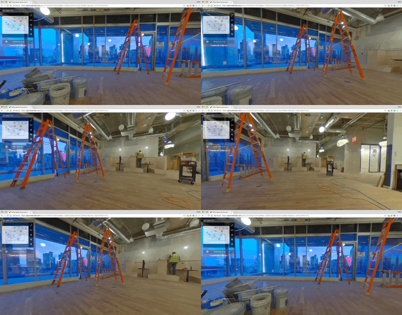
360 Site Walk-Through
Construction teams, consultants, investors, and remote stakeholders are not always able to physically visit a project site, making it difficult to review conditions, monitor progress, or reference completed work remotely.
SiteVector provides interactive 360° walkthrough documentation that allows project teams and stakeholders to remotely review site conditions and maintain accessible visual records throughout construction.
Orthomosaics & Overlays
Construction teams, developers, and project stakeholders often rely on fragmented site photos and outdated references, making it difficult to clearly understand overall site conditions and compare field progress against plans or previous captures.
SiteVector provides high-resolution orthomosaic mapping and overlay imagery that creates accurate, scalable site visuals for progress tracking, documentation, planning reference, and visual comparison over time.
